Motorcycles and places to photograph.

“I may not have a therapist, but I do have my motorcycle.”

Irish Photo Rally 2025, It’s been a couple of years since I done any of the photo points but I decided to do some of them this year. Not sure I’ll get round them all but there’s still time.

For those that do not know what the Irish Photo rally is, at it’s simplest there are 24 points across Ireland where you ride your motorcycle too and photograph it at each point. The points change each year and take you to places you would never think of going. A great way to see the Island and the diversity of the history and landscapes it offers. There is no order in which you have to follow when doing them, for me I break the points into day rides and weekend breaks. So anything north of Dublin I can cover in day rides, South of Dublin weekend breaks.

Here is a link to the Irish Photo Rally site, the map and locations. https://irishphotorally.ie

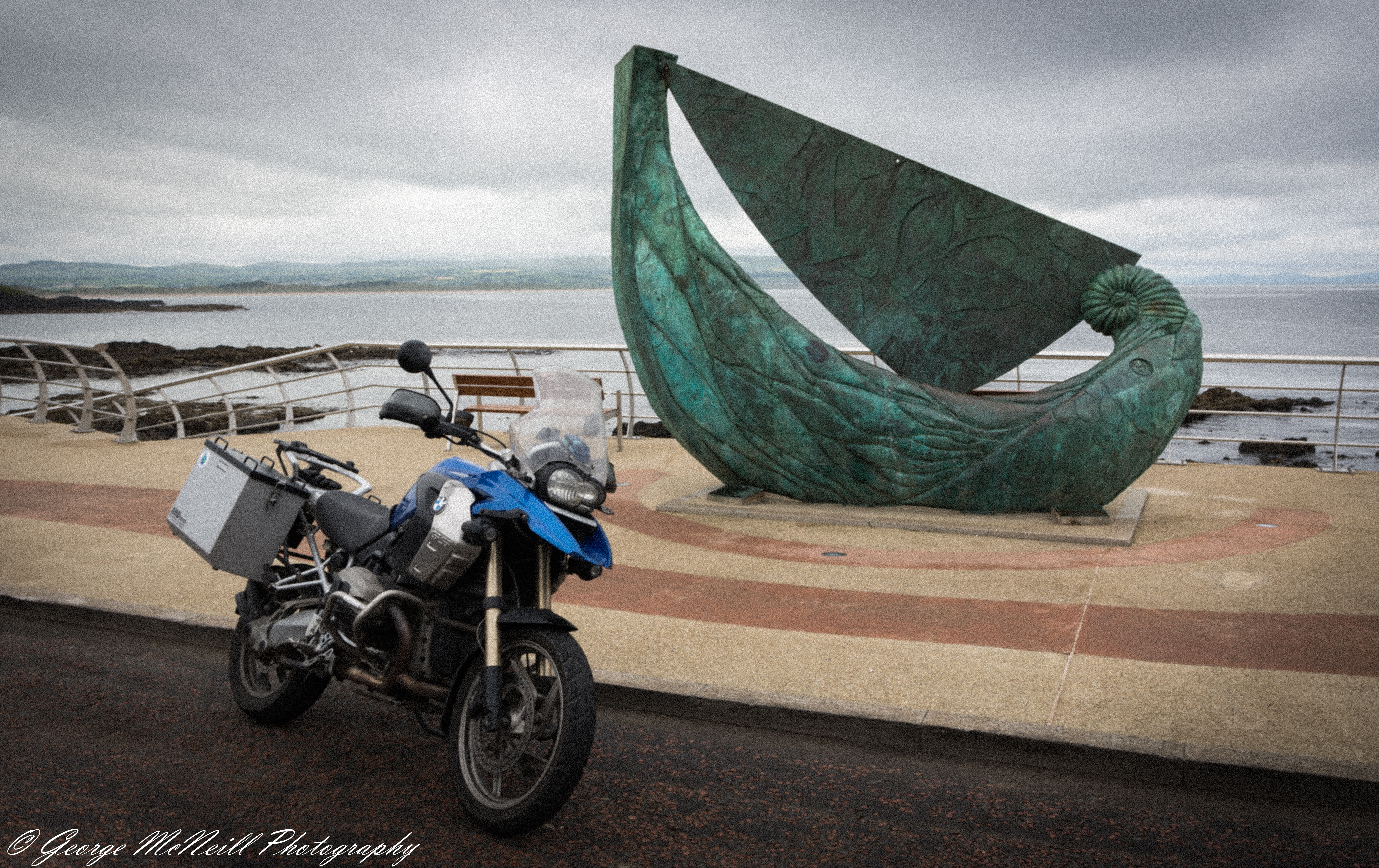
My day out covered about 270 miles/ 400km and it took in five rally points, numbers 4,6,5,7 and 8 in that order.
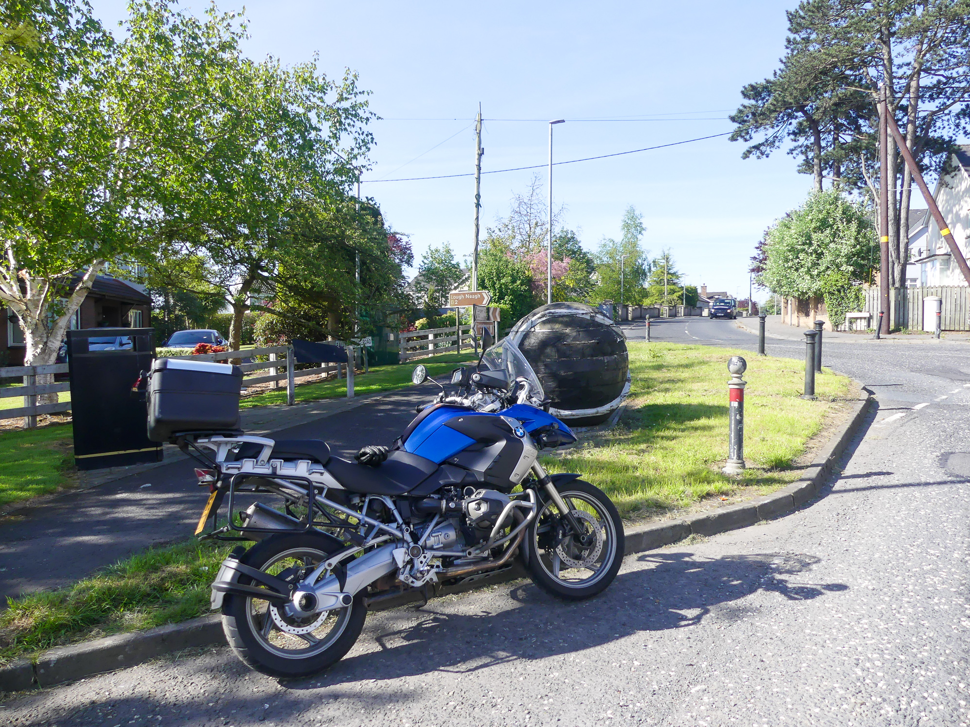
Number:4
Region: “Down/Armagh”
Province: Ulster
Name: Giant Sliotar
3km W of Lurgan
Coordinates:
Irish Grid : IJ 04891 58928   
Degrees Minutes Seconds : N54 28’ 05″ W6 22’ 59″

Sliotar

A sliotar or Sliothar is a hard solid sphere slightly larger than a tennis ball, consisting of a cork core covered by two pieces of leather stitched together. Sometimes called a “hurling ball”, it resembles a baseball with more pronounced stitching. It is used in the Gaelic games of hurling, camogie, rounders and shinty. Wikipedia
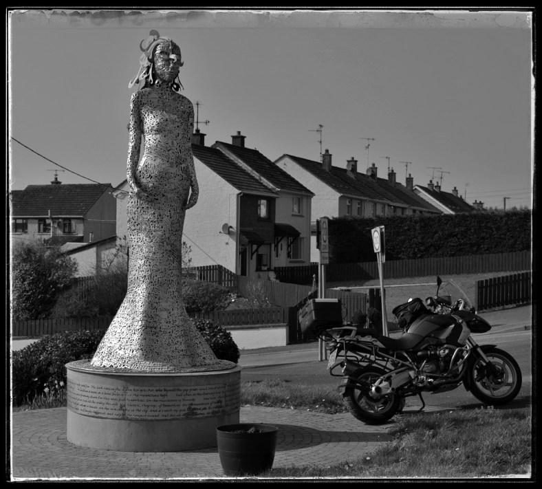
Number:6
Region: “Fermanagh/Tyrone”
Province: Ulster
Name: The Big Lathe
Coalisland
Coordinates:
Irish Grid :  IH 83780 662870
Degrees Minutes Seconds:  N54 32’ 17″ W6 42’ 23″

I have included the coordinates with each photo for those that wish to see the street views on Google maps if they are available.
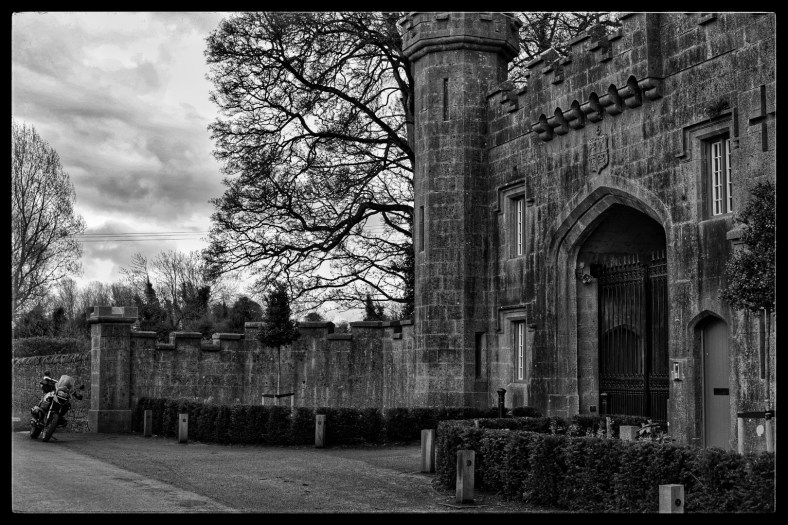
Number:5
Region: “Cavan/Monaghan”
Province: Ulster
Name: Derryheen Church of Ireland
2km W of Butlersbridge
Coordinates:
Irish Grid : IH 39117 09994
 Degrees Minutes Seconds : N54 02’ 16″ W7 24’ 13″

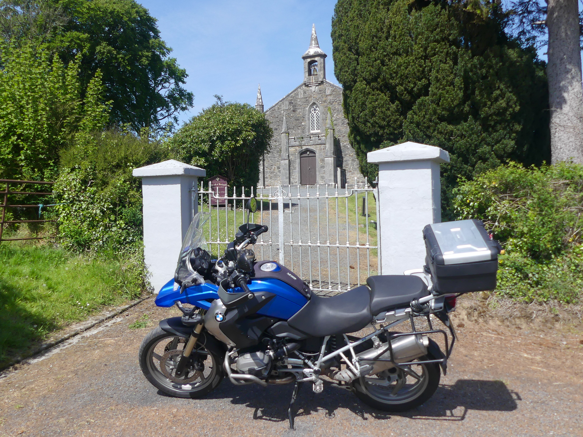
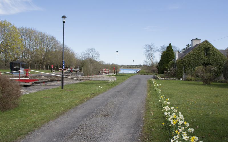
I will have to remember to stop and take some photo’s from the places I pass through, I just remembered this area had beautiful country side with great views across small lakes. I do this all the time, I enjoy ride riding my bike, admiring the views but forget to record them. I’ll have to try and show more of this beautiful island I live on.

Here’s is a link to the famous ‘Myles the Slasher’ http://www.irishidentity.com/stories/myles.htm

It was a warm day and motorcycle gear is great while riding but you overheat when stopped, There was a little cloud cover where I took this photograph. I got a bottle of water from the little shop in the background and the lady serving was saying, it’s great having all these good looking bikers calling in to see her, but there was a few exceptions. Hmmm. Sure the Irish have a great sense of humour.

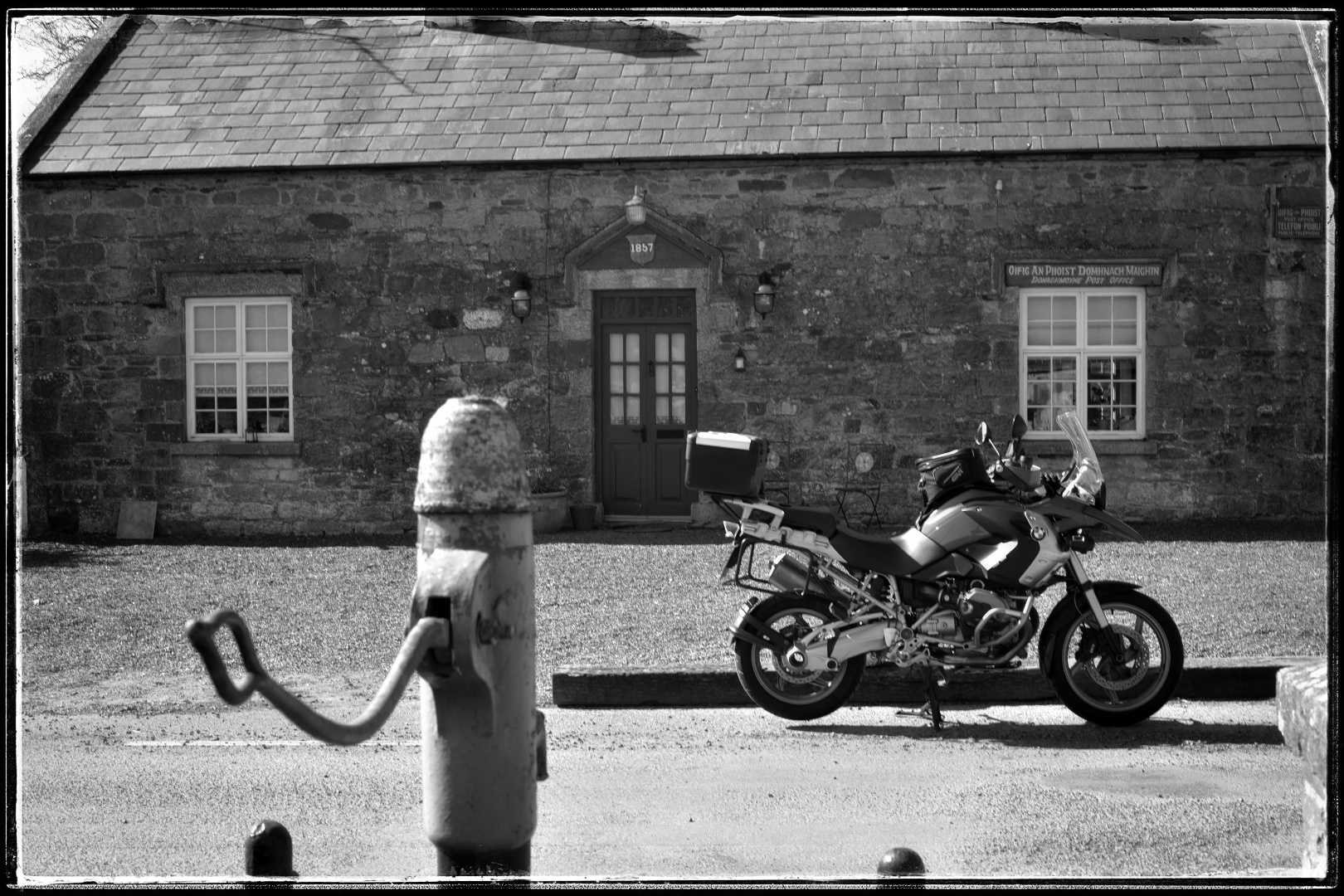
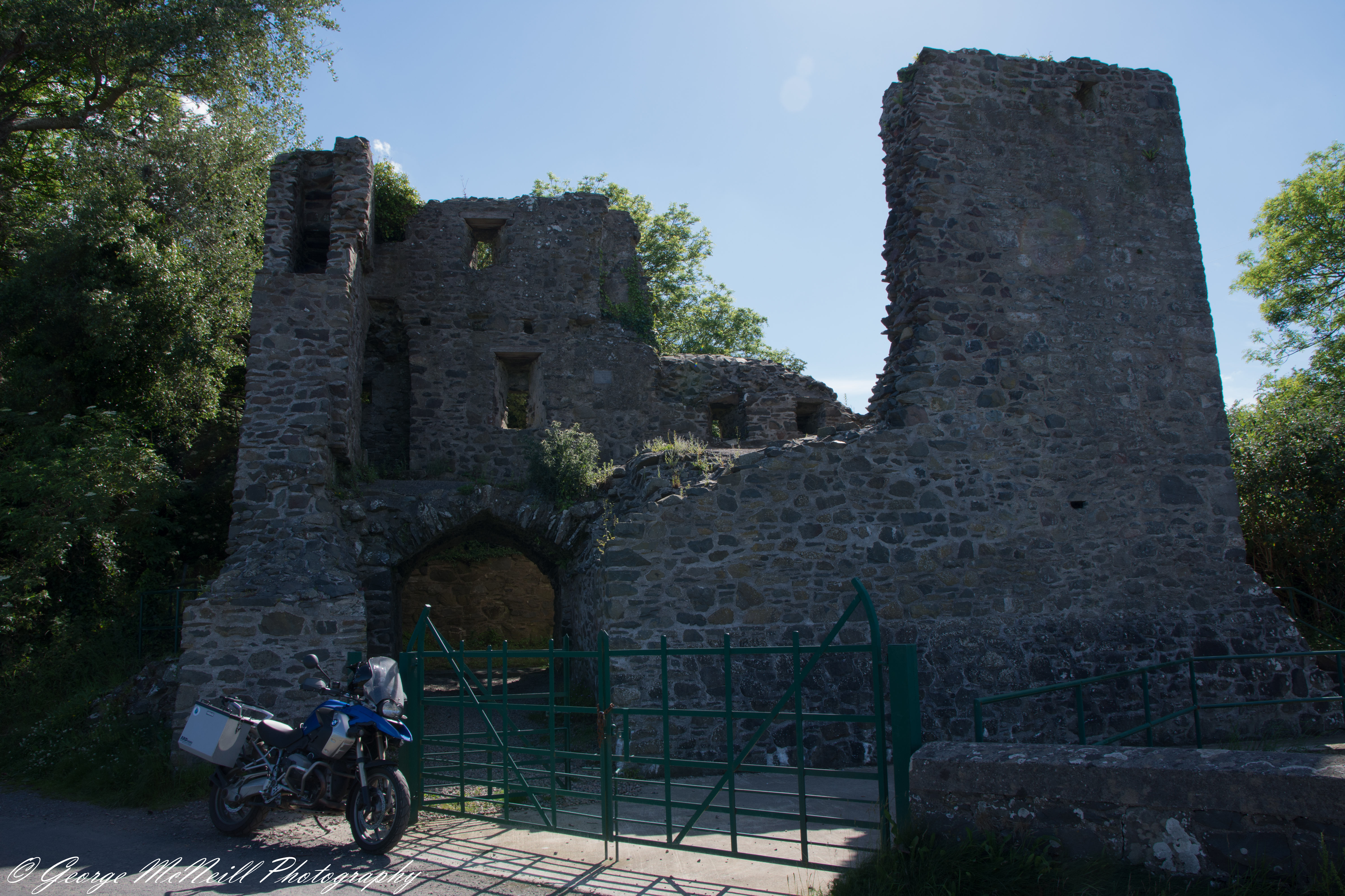
So it’s on to the last one of the day, this one had me looking for something I discovered does not exist anymore. But there is a sign.

Number:8
Region: “Louth/Meath”
Province: Leinster
Name: Postman’s Hut
10km west of Kells
Coordinates:
Irish Grid : IN 63627 76594
Degrees Minutes Seconds:  N53 44′ 07″ W7 02′ 12″

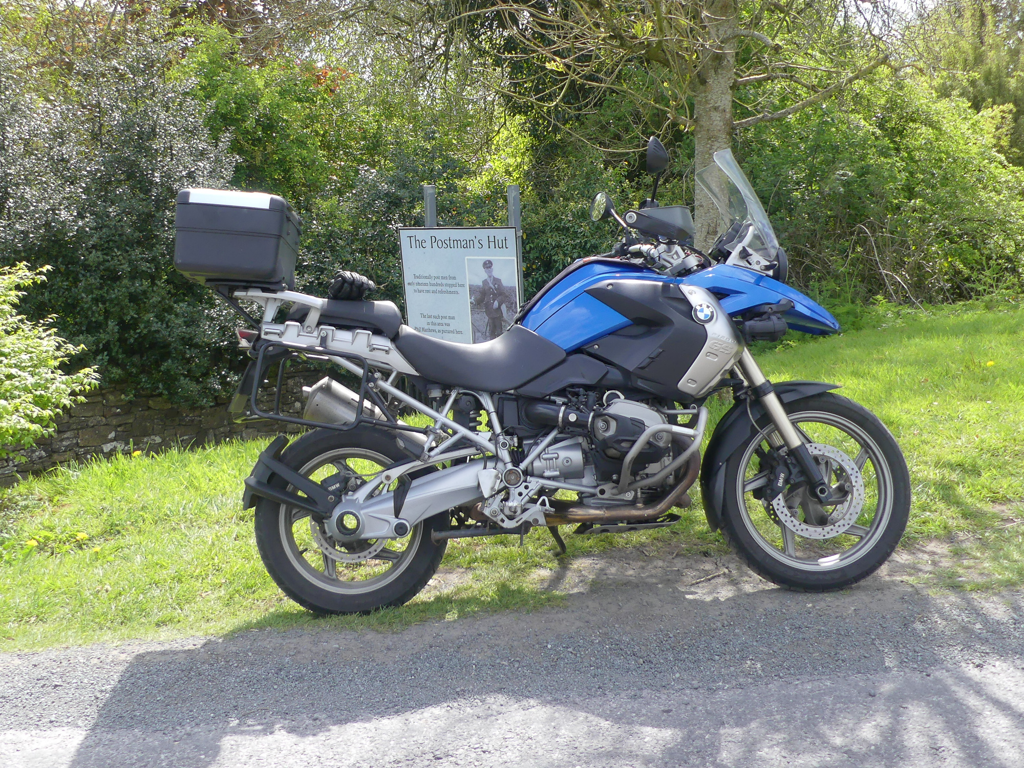
Okay, I know I took a few more photograph’s of this site where the last postman hut stood. I can’t find them. This reminds me of standing in front of my school teacher telling her the dog eat my homework, honest Miss young it did…

There are good views of this on Google street view, I did check..

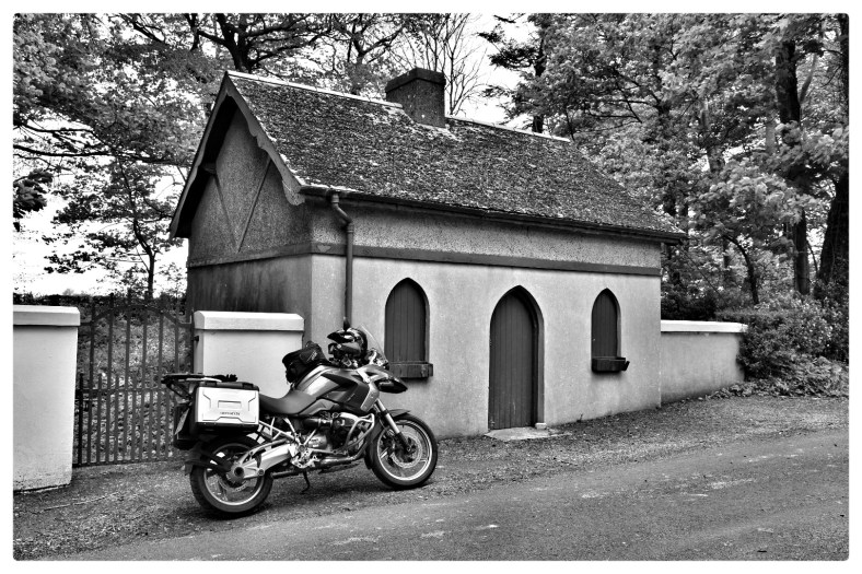
For those that have made it this far Thank you for joining me on my day out. I will try and take some non- photo rally photographs on my journey’s to other rally points.

Leave a comment

52 week Black and White

Week 10

I have missed a couple of week’s posts due to a bout of illness. But back on track, so we are going to Ballydevitt Cottage in County Londonderry . I have tried to find some history about this small cottage,without success.

I talked to a local couple but they are only a few years in the area, so at some point I will go back and see if I can get some information about it’s history.

Ballydevitt Cottage

This is another Irish photo rally point, it’s in Aghadowey, County Londonderry.

I’m going to add the coordinates which you can copy to Google maps and go to street view to see the location.

55. 03506100° – 6.64184700°

Have a great weekend and take care.

George☘️

52 week Black and White

Week 9

This week I’m in Downings (Na Dunaibh) in the north of County Donegal.

This photo is of the Laurentic Gun at Downings Pier.

Laurentic gun at Downings Pier.

The following links give the history of the gun the ship and the gold that it was carring when sunk. .

https://www.inishowennews.com/LGun.htm

https://www.whitestarhistory.com/laurentic1

https://en.wikipedia.org/wiki/SS_Laurentic_(1908)

Thank you for visiting.

George ☘️

52 week Black and White

week five.

So with a mini heat wave this week I got out on the motorbike. I done one off the Irish photo rally points. http://www.irishphotorally.ie/

For those that look at the I. P. R site this photo is number five on the map.

This is the old Water pump/post office in Donaghmoyne in County Monaghan.

The date above the door is 1857, not sure if it was a post office from that date.. Today it could be somes home.

The m/c is a BMW r1200gs and me and this old girl has covered many happy miles. Hopefully a few more this year.

Black & White Wednesday

This weeks photograph come from County Fermanagh, Northern Ireland. It was one of the Photo points (No.6) on the Irish photo rally 2020. (Link below) The idea is to ride and photograph your motorcycle at each of the given locations. You get to see parts of Ireland you would never dream for going to.

Rossinver Mór National School.

Picture info: Nikon D7200 camera, Sigma 17 – 70mm lens: 1/20sec @ f11 22mm and ISO 126

Irish Photo Rally 2020 info here: http://www.irishphotorally.ie/map

Thank you for visiting.

George.

Two more photo rally points.

For those that don’t know the Photo rally points are, they are from The Irish Photo Rally 2018. Info about the photo rally and a map with the photo points on it are HERE .

So my route for my first photo today take me across Ireland toward the west coast. It’s number 21 on the map and it’s in county Sligo. It was a foggy start to the morning but traffic was light and after 30 mile the sun had broke through. It was going to be warm, my first stop for a coffee and fuel was in Enniskillen . Jacket air vents opened it was southwest to the village of Belcoo

Photo rally 2018-3216.jpg

Photo rally 2018-3219.jpg

Lough MaCnean

then Manorhamiton.  A few miles pass Manorhamilton I turn onto the R826 , pass the shore of Lough Gill and on to the town of Drumahair. I followed small single track roads till i was south of Sligo Town. Back roads around to the Beach Bar and follow the coast through Easky where another coffee had my name on it. Continuing on the R297  till i was south of Enniscrone at the Photo rally point ‘ The Black pig’

Photo rally 2018-3225.jpg

Photo rally 2018-3226.jpg

The Black Pig.

With the photo taken another motorcyclist arrived and a few minutes chatting about the rally points and where I was going next. Well my next point was number 23 on the map, County Rosscommon . Put the coordinates into the Sat-nav  and set it of winding roads. Love doing this for it takes all the small roads that winds through the country side. I stopped a service area to get a bite to eat and refuel the bike. Sitting outside in the sun this Blacksmiths workshop was across the road.

Photo rally 2018-3228.jpg

I looked the internet and found he is an artist/blacksmith. a link to some of his WORK.

One of my problems while riding is I enjoy it so much, I forget to stop and take photos. I keep saying I will but ….. so not a lot to show on this next leg of my trip. My next point was the Albert Lock.

Photo rally 2018-3237.jpg

Photo rally 2018-3244.jpg

The lock on the left with Lough Nanoge in the background. The lough os part of the river Shannon network.Photo rally 2018-3240.jpg

The Lock keeper’s cottage.

A chat with the lock keeper and the chance to see a boat using it it was time for a long ride home. That ride would see me cover another six counties. Near 12 hours on the road that day, it was a tired body that walked into the house.

Thank you for visiting and joining me on my trips.

George.

Irish photo Rally 2017

A beautiful morning greeted me on awaking, sun lighting up the bedroom and birds singing. Shower and dressed I was ready for the road. Open vents in my jacket and sort light weight gloves, fire up the bike and I’m off. Four mile up the road and I’m riding in thick fog, forty miles later and I’m still in it. My first point today is on the north coast of Ireland, its number 2 on the rally map . Portstewart harbour and the Jimmy Kennedy memorial. The Fishing boat.

The fishing boat.JPG

Has you can see it was a gray day here, in fact its rain lightly. Jimmy kennedy was a song writer born in Northern Ireland, wrote songs sung by Elvis Presley, Frank Sinatra and other great singers. Jimmy Kennedy There’s an art gallery and cafe across the road so a cup of coffee and its time to go. Head across the north coast towards the east coast and follow it south. A short ride over to Portrush take me along part of the North West 200 road race. The track is along public roads which they close while the motorcycle races are taking place. Speeds in access of 200 mph / 321kph are hit on parts of the circuit. Heres a link to a You Tube clip of the racing. NW 200 .

Leaving Portrush for the coast road running down the east side of the country the rain is falling but the sky is clear ahead.  The first town I come to is Bushmills. For any whisky drinkers out there this is where the famous Bushmills whisky is distilled. Bushmills . Okay for those that opened the link, I thought you might enjoy the it. Turning left in the centre of town and continue along the coastal route. Today I give the town of Dunseverick a miss and turn off for Ballintoy harbour.  Down pass the small white church and follow the narrow winding road down to the harbour.

Ballintoy Harbour.JPG

Ballintoy Harbour2.JPG

Just before you turn down into harbour you pass ‘Bendhu’, this house was built by a artist from Cornwall in the south of England. Another link Bendhu . Please visit this link to see and learn about this piece of art.

A coffee and a chat with a couple from Hungary touring on a motorcycle and its time to continue south. Has you climb out of Ballintoy village you pass the Carrick-na-reed rope bridge.

carrick.na.reed.jpg

The next town on route it Ballycastle. Every year they have Irelands oldest fair here in August, The Auld Lammas Fair is held over two days. Six miles off the coast is the island of Rathlin. A beautiful island where you can walk on roads and never see any traffic. There are three lighthouses on the island with one being a bird sanctuary where  sea bird come to breed every year.  Getting across is on a small ferry, foot passage only.

Out of town and I go down a small road that splits the golf course in two, and pull over to look across at Rathlin and the Scottish hills. Rarhlin was just showing through the sea mist and Scotland could not be seen.

Ballycastle beach and town.JPG

This is Ballycastle beach looking back towards the town. Has the photo shows it was still cloudy but warm and dry. The hills in the background is north and the road I traveled down follows them. South and I take the Tor head road that hugs the rugged coast with fantastic views across the Irish sea into Scotland. will there would be if this sea mist clears. Next stop is Murlough, a viewing point with great sea views.


P1040135.jpg

This shot see’s the mist clearing and the sun has dropped in to say hello. That is one of Rathlin Islands lighthouse’s in the mid ground and Scotland in the background. Scotland is only 13 mile across from Ireland at this point. From here its follow the road around around to Cushendun where there is a grand little tea room beside the harbour. No luck this time for it is full so needing fuel I head on to Cushendall. While stopped for fuel my sister and hubby stopped. Never know who you meet…. great to see them. My next point is inland a few miles from Ballygally, another small seaside town. This time its up into the hills and another view point and my rally point. A plaque To Judge Richard Campbell (1870-1935) link It was non stop down the coast road to Larne. If you ride a motorcycle this ranks has one of the great motorcyclist road in the world. Sandwiched between rock face and just a stone wall with the sea lapping on the other side it makes some riders nervous and others love the thrill of riding this fast.  From Larne I follow the coast around through Carrickfergus. There is a Norman castle here worth a visit if you happen to be passing this way. Castle.

From Carrick has we call it here in the north it was onto Belfast and Stop for a coffee. From Belfast it over to Comber on the shore of Strangford lough and follow the lough shore around to Mahee Island. These small isles are connected with man made causeways. And this time it Mahee/Hendrum castle is the rally photo. The temperature has climbed and now when I stop the jacket has to come off.

castle.JPG

With the sky clear and the sun high its not great for photography.  But its the last for this trip, I strap the jacket to the bike and its tee shirt and sunshine for the trip back home.

A few hundred metre’s from here is  Nendrum Monastic site, with some great views and the remains of an old Monastery dating  back to the 5th century. But that will be another trip and post.

Thank you all for visiting.